Before we start driving for hours you should definitely be leveraging the resources you have available before you get there. Some “pre-scouting” if you will. Most people’s first stop is Google Earth and why not? It’s a great resource.
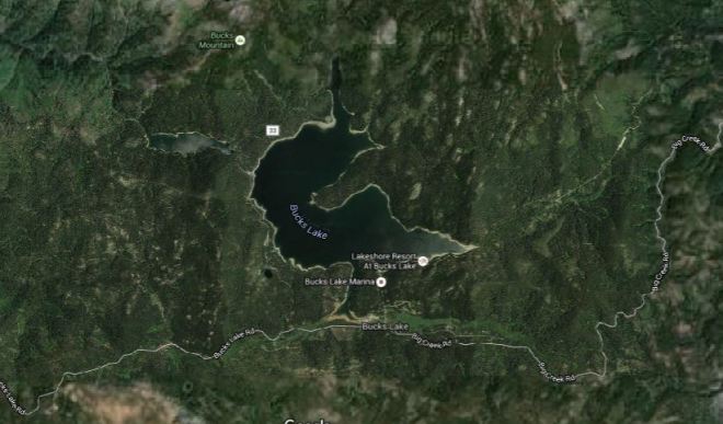
One of the things I quickly learned is this seems to be a heavily used lake. There’s a marina, cabins, boat rentals, several camp grounds all around the lake. This could mean many different things.. The deer may be used to people and stay in the area or it may pressure them away. IF I hunt this area I’m unsure at what time during the season I will hunt it. I will plan as if I’m going to hunt late in the season, which means this area will be heavily pressured.
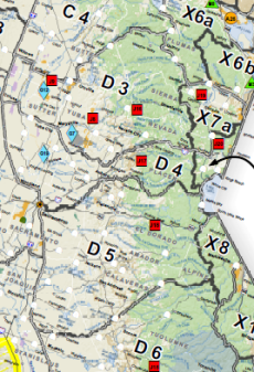
As you can see from the above photo there are several roads zig zigging through the entire area. This is not a good sign for late season hunting. This area will likely be heavily traveled by road hunters and OHV users. Road hunters are people who’s idea of hunting is driving around until you see a deer and then shooting it, often times from the road. Shooting from the road, unless you are disabled, with the proper permit, is illegal and unethical.
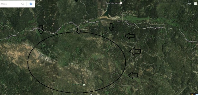
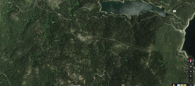
We may be able to leverage this road hunting and general access pressure to our advantage. Below the lake is an area with very little vehicle access and it also has a pond in the upper left part of the circle. The arrows represent the potential pressure being placed on the deer by vehicle traffic.
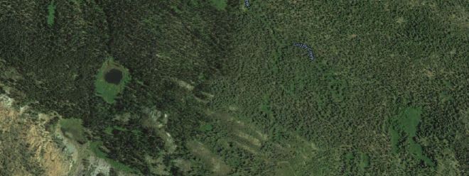
Let’s take a closer look at that pond. In the summer time that pond may provide some relief for wildlife not wanting to go near the people at the lake. This would be a good place to look for deer trails. I would not set up on the pond itself because doing so would pressure other wildlife away from the water which they need to survive the hot summers. Instead look for access trails and try to find where you can intercept them on their way to/from the pond.
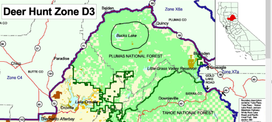
A lot of the lower lake’s property is private, we still need to make sure this is area is public property. Below is a snip from http://www.fs.usda.gov/Internet/FSE_DOCUMENTS/stelprdb5323336.pdf
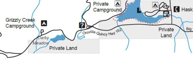
It’s hard to tell from the above map. I will have to reference my On X Hunt map which will tell me for sure.
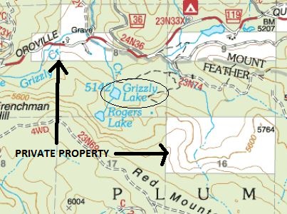
EDIT: I was able to look on my OnX HUNT app and the “pond” is not private property. It’s actually called Grizzly Lake, but from the severe drought we’ve had it appears to be just a pond now. I highly recommend the OnX HUNT app. Let there be no doubt about where you’re hunting. I will review the app in a separate post. I hope to get a screen shot of the app up at some point, but for now here is a topo map showing the lake in relation to the surrounding private properties.
Stay tuned. Hopefully we can actually get up to the lake soon.